


Chorlton-cum-HardyHistoric Map wooden coaster
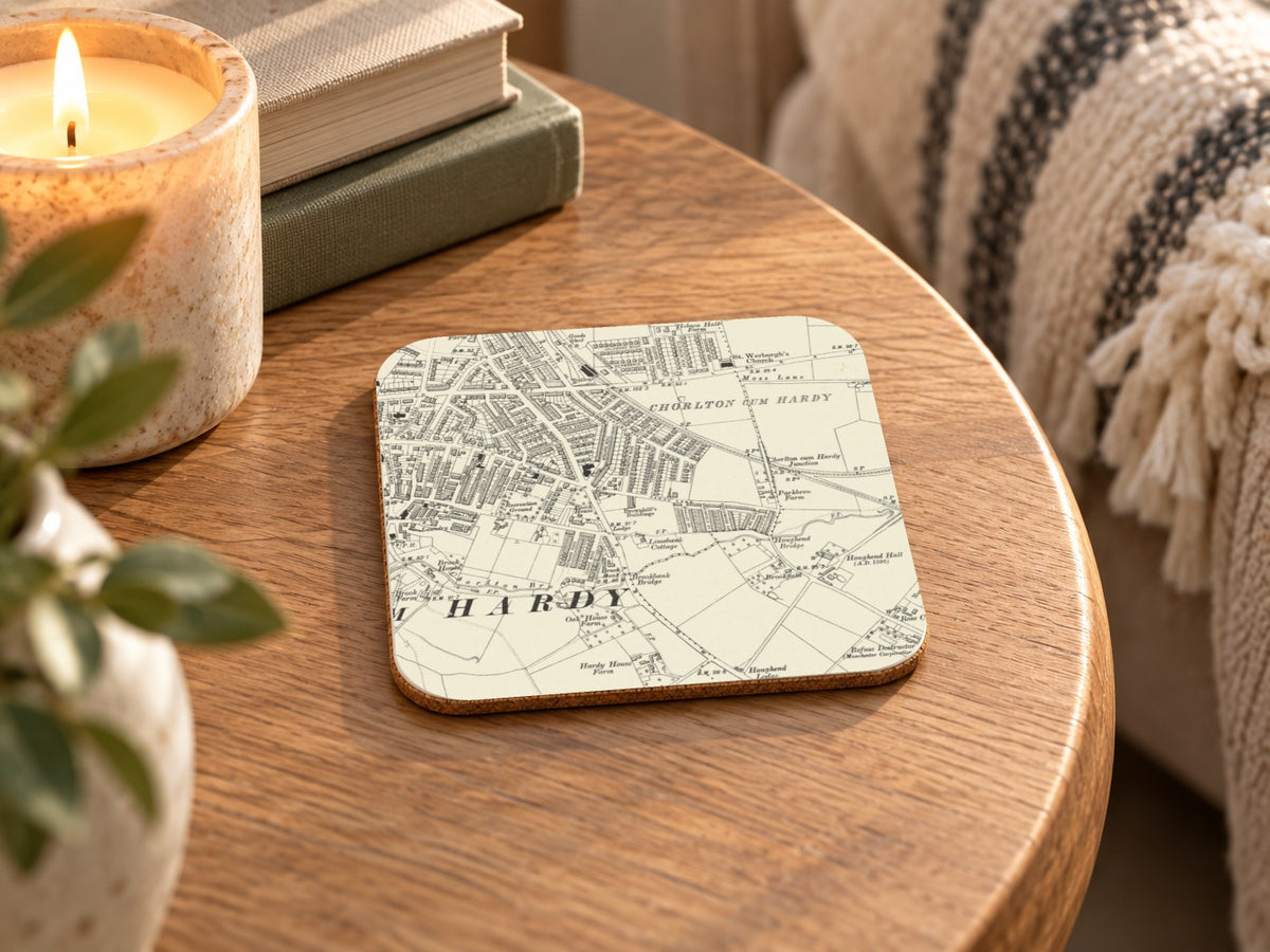
Chorlton-cum-Hardy Historic Map wooden coaster
Couldn't load pickup availability
- Printed to order in Britain
- Reproduced from the original in the National Library of Scotland
- Arrives with a card naming the sheet, the survey and the year
A historic view of Chorlton-cum-Hardy in Ordnance Survey Second Edition Six-Inch mapping, reproduced as a wooden coaster.
What this map covers
This product uses the reviewed historic-map view of Chorlton-cum-Hardy shown in the listing imagery.
About this map
This artwork is cropped from Ordnance Survey six-inch sheets Cheshire IX.SE; Lancashire CXI.NW, 1899–1908, focusing the original cartography around Chorlton-cum-Hardy rather than reproducing the complete historic sheet.
The series combines the breadth of Six-Inch county mapping with systematic revision, making change itself part of what is interesting about the sheet. Six inches represent one mile, providing much more local information than a touring map while retaining the wider landscape context that 25-Inch plans can lose.
Revision does not make these maps visually modern; instead it layers later streets, railways, works, and altered boundaries into the established County Series style. Successive revision turned the County Series into a record of change rather than a single nineteenth-century snapshot. This particular source was revised in 1897–1905 and published in 1899–1908.
About the product
Made to order. Shipping is calculated at checkout.
- 100 × 100 mm
- 4mm medium-density fibreboard
- protective cork underside
- single 100 × 100 mm coaster
- square shape
- high-gloss printed surface
- dye-sublimation printing
- Gently wipe clean.
A note on map detail
Historic map detail varies with product size and material. Use the listing close-ups as your guide to the exact crop and level of detail.
- Colours may print slightly warmer because of the base material.
Map source
Historic map image: National Library of Scotland https://maps.nls.uk/
Cartography: Ordnance Survey
About There & Then
There & Then brings archival cartography back into everyday use, creating pieces designed to be seen and lived with at home.


SIX-INCH · REVISED
Chorlton-cum-Hardy
- Map
- Os six inch revised
- County
- Lancashire
- Original
- National Library of Scotland