


Chorlton-cum-HardyHistoric Map Mug
Chorlton-cum-Hardy Historic Map Mug
Couldn't load pickup availability
- Printed to order in Britain
- Reproduced from the original in the National Library of Scotland
- Arrives with a card naming the sheet, the survey and the year
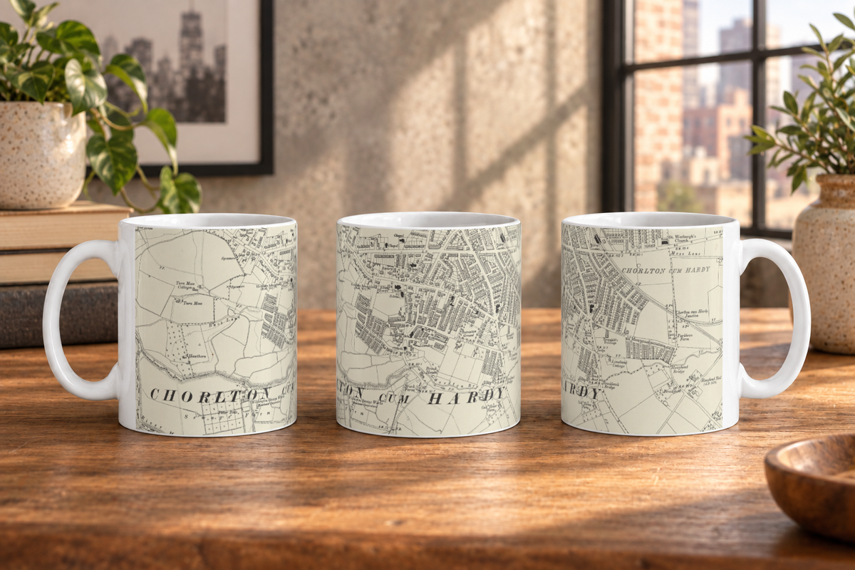
A mug of Chorlton-cum-Hardy, reproduced from Ordnance Survey Second Edition Six-Inch mapping.
What this map covers
The geographic coverage follows the exact product crop of Chorlton-cum-Hardy shown in the listing imagery.
About this map
This artwork is cropped from Ordnance Survey six-inch sheets Cheshire IX.SE; Lancashire CXI.NW, 1899–1908, focusing the original cartography around Chorlton-cum-Hardy rather than reproducing the complete historic sheet.
Successive revision turned the County Series into a record of change rather than a single nineteenth-century snapshot. The Second Edition Six-Inch maps revised the earlier county surveys, keeping the same detailed topographic scale while bringing streets, railways, industry, boundaries, and other changed features up to date.
The interest often lies in small changes spread across a large amount of surviving landscape detail, rather than in one dramatic landmark. Its visual character remains that of a measured county survey: fine linework, boundaries, buildings, routes, water, and a large amount of historic naming. This particular source was revised in 1897–1905 and published in 1899–1908.
About the product
Made to order. Shipping is calculated at checkout.
- 11 oz · 229 × 95 mm print area
- white ceramic
- 11oz capacity
- straight-sided profile
- wraparound exterior print
- protective polished ceramic glaze
- dye-sublimation printing
- Dishwasher and microwave safe.
A note on map detail
Historic map detail varies with product size and material. Use the listing close-ups as your guide to the exact crop and level of detail.
Map source
Historic map image: National Library of Scotland https://maps.nls.uk/
Cartography: Ordnance Survey
About There & Then
There & Then brings archival cartography back into everyday use, creating pieces designed to be seen and lived with at home.


SIX-INCH · REVISED
Chorlton-cum-Hardy
- Map
- Os six inch revised
- County
- Lancashire
- Original
- National Library of Scotland